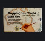
Mapping the World with Art (Digital Download)
$18.95
Instant digital download version of “Mapping the World with Art.”
- Description
Description
“Mapping the World with Art” This version of the curriculum comes to you instantly as a digital download “ebook.” It is a PDF file of the textbook. You can choose to read most of it electronically and just print the pages you need for activities, or you can print out the whole booklet using your own printer or by putting the file onto a disc (or jump drive) and taking it to a copy shop. You may make copies for your own personal use at home or in your own classroom. (Please do not re-sell any copies you make. Thanks.)
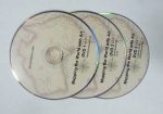
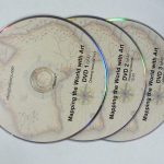
NOTE: This download contains ONLY the book. If you want the DVDs, you will have to order them separately. If you’d like to stream the videos, please check out the Mapping the World VIDEO ECOURSE, listed separately. The ecourse gives you both the book and the links for the video lessons.
VIDEO REVIEW of the curriculum: https://youtu.be/dq5pXZ-FeR4
FREE SAMPLES:
Click here to download the first three chapters (history, drawings, activities)
Click here to download the table of contents
Click here to see the video lesson for drawing 1
Click here to see the video lesson for drawing 2
Click here to see the video lesson for drawing 3
Target age group: 10-16 (history text and drawing lessons are appropriate for over 16, or even adult learners)
Structure of curriculum: This curriculum is in 3 parts:
Part 1 contains 30 short history lessons. Each lesson is one double-sided page. The writing is straightforward and easy to understand and is accessible to younger students, but it does not have a patronizing “written for kids” tone, and thus is appropriate reading for older students as well. The drawing lessons and activities are based on the themes of the history lessons. The lessons start with the beginnings of cartography in ancient Greece, and end with the official discovery of Antarctica in the 1800s.
Part 2 contains the drawing lessons. Each drawing lesson has step-by-step pictures that guide the student as they draw an area of the world from scratch (starting with nothing but a blank piece of paper). This method of learning is absolutely ideal for kinetic learners, but I have found it extremely effective for all types of learners. (I found it so effective that after writing “Mapping the World” I now use at least one “draw-from-scratch” activity in every subject I teach.) The drawing lessons progress in such a way that later drawings incorporate earlier ones. For example, in one of the first lessons you learn to draw the Nile River. Later, when you draw Africa, you already know how to draw the Nile. The drawing lessons tend to stay away from political boundaries, although some could not be avoided (France and Spain, for example).
Part 3 contains extra activities and worksheets that go with the history lessons and/or the drawing lessons. Activities include extra worksheets for practicing what was learned in the drawing lessons, group games, board games, crafts such as making simple navigational instruments, or art projects (about maps) using paint, crayons or colored pencils. There are also many supplemental videos suggested, all of which can be accessed for free via the Internet. The videos are mostly documentaries about the navigators who sailed around the world, or brief video visits to the places the students have drawn.
SPECIAL ADDED FEATURE: As a supplement to the printed drawing lessons, I have recorded (in my basement workshop– I don’t have access to expensive video equipment) three DVDs that contain videos of each drawing lesson. If you or your student has trouble following step-by-step pictures (which I know are troublesome for some types of learners) you can watch the video of the lessons to get the general idea of how to do the drawing. PLEASE NOTE: I’ve found that some people regard these DVDs as the main part of this whole curriculum. I consider them to be just a supplement, not the focus. Please don’t rely on just the video demonstrations. Have the printed versions of the lessons near at hand so you can refer to them for sharper images of sketch lines and labels.
(ERRATA: Someone brought to my attention that I had reversed the labels on Corsica and Sardinia on DVD lesson 4. The written instructions in the booklet are correct. Please make a note of this until I can release a corrected DVD. Thanks.)
Time needed to complete the curriculum: Personally, I would use this curriculum over the course of the entire year, using one chapter per week. I’d do the history lesson and drawing one day, and one or more of the activities on another day of that same week. However, you may use this curriculum however you want to. You may have a student who wants to zip through the drawings at a fast pace. That’s fine. Do whatever works for you.
FAQs:
— How much would it cost to print out the book using my own printer? Printing out the entire book can be a bit pricey, as there are so many color pages. If you own a laser printer, you can probably print out a copy of the entire book for about 3 cents a page, which would be a total of around $10 US dollars. Copy shops may charge as much as $30 USD to print the book. And that’s not including binding. You might find that it is actually cheaper to order the paperback version on Amazon.com or any other online book seller.
— Can I use this curriculum in conjunction with another? Yes, the history lessons are brief, so it would not be too much for your student(s) to read other history lessons alongside these. A book that dovetails particularly well is “Around the World in 100 Years” by Jean Fritz.
— Can I just use bits and pieces of this curriculum without using the whole thing? You can use as much or as little of it as you want to. Just pick and choose what you want to use. Some people just choose the drawing lessons that are helpful at certain points in their own curriculum. (However, please note that some of the later drawings lessons do use bits and pieces from earlier ones.
— Can I use this with multiple age groups? Yes. In fact, this curriculum is ideal for using with mixed ages. I’ve heard back from customers who have used this curriculum with students as young as 7 or 8 (although I really don’t recommend it for kids this young) and as old as 18.
— Can I use this curriculum with a group? Yes, it is great for using with a group. Even if you have no art skills at all, you can offer your group a geography drawing class. Just pop the DVDs into a DVD player and have the group watch the drawing lessons. This is especially helpful if your group has a very small budget and can’t require that each family purchase the curriculum themselves.
— Can I get extra copies of the curriculum on CD to give to students in a group? Yes, just contact me about bulk discounts.
— Can I get a replacement DVD if I lost one? Yes, just contact me by email.
— Is the similarity of your title to “Mapping the World by Heart” intentional? Somewhat. My curriculum was born out of my frustration and sense of disappointment with that curriculum. I determined I could do better. I knew that it was likely that many people had experienced what I had– thinking the curriculum was going to provide real instruction and finding it did not. I had already signed up for a whole year of teaching art and geography to a large group of kids, so I had no choice but to write my own materials week by week. That’s how the book came about.
— Can I fit this in somehow with Classical Conversations Challenge A?
Mapping the World through Art is BEST used as a precursor to Challenge A. It breaks down the process of drawing the world’s coastlines and makes it seem like a manageable task. I used this book the year before we did Challenge A and it was a big help.
The order, pace and priorities are very different, though. Mapping the World through Art puts a lot of emphasis on getting proportions right, whereas the most successful memorizers in CC were the ones whose Florida still looked like a lollipop stick, and whose United States was disproportionately large (which allows for labeling more features) compared to their tiny Asia. (They put very little emphasis on the features, if you want to know where to cut back on the work. Assuming your tutor is working with the same philosophy that my child’s tutor was, there were some things she drilled in class through fun games… other details were up to the discretion of the family and many chose to shorten the memorization lists.)
You will find that Mapping the World through Art will give you successful quick strategies for drawing Central America (particularly the islands, which are challenging) and South America. It will not help you much at all when drawing Canada and the US, since it does not address any geopolitical boundaries.
In the spring you will find that it will be a little hard to find the instructions for the coastline of Europe and Asia, since they are done in order of historical importance for the purpose of Mapping the World through Art. I love the idea of walking through history while drawing the world (and we remembered so many interesting facts because of our time using MTWTA), but this is not the order of memorization and drawing in ChA. If you have time to develop your skills, you would certainly be able to figure it out, but it won’t be quick work. Africa, on the other hand, would be easy enough to find and draw from Mapping the World through Art, although again none of these continents will be presented with country boundaries. You will find many new strategies for drawing as you work, and Europe and Asia won’t scare you as much then as they do now. (Also you will get 5 weeks on each one, so the most important idea to focus on for those continents is time management.)
No matter how you choose to do it, the important thing to remember for the purpose of Challenge A geography is that you must get to the blank sheet of paper quickly. Our best weapons for last year were repetitive tracing, and paper folding that broke the paper into chunks. My son did find that South America and Central America were very easy for him because of his prior knowledge of how to draw the shapes (as I mentioned we had done some of the lessons from Mapping the World through Art the previous year). Africa was also easier for him, I think, for the same reason.