Map drawing videos
Map Drawing Videos
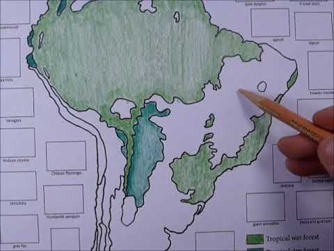

Biomes of South America map coloring activity (target ages: 8 to 12)
In this activity, we color a map showing the major biomes of South America. Additionally, there are also pictures of South American animals that you can paste into the area around the continent.

Label the deserts of the world– this version has the names printed already, but it is the exact same map as the video directly above this one.
Click here to download template for this drawing (this version with the names printed already)

“Where are the deserts, and why are they there?” (52 minutes, ages 10-16)
Reviews reasons why deserts form in certain locations, such as high pressure zones, cold ocean currents, rain shadows.
Click here to download template page for “Where are the deserts?”

Label the deserts of the world
In this version of the activity, the student is asked to write all the words themselves. For a version with the words printed already, see the video directly below.
Click here to download template for this version of the map activity